The national map and the report on hydrogeological instability: two tools to learn more about the Italian territory and prevent risks
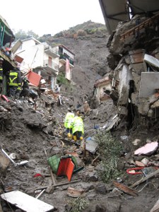
The recent landslides of Marianello in Licata, Zingarello in Agrigento, Chiaia in Procida and Chiaia di Luna in Ponza are among the areas of danger for landslides indicated in the map. There is, and has been updated by ISPRA, the national map of hydrogeological instability built with data provide by the District Basin Authorities. The Institute describes it in the recently published report, providing the reference framework on the danger to landslides and floods of the entire national territory and on the risk indicators related to population, families, buildings, businesses and cultural heritage.
Hydrogeological instability in Italy ; risk indicators – edition 2018

