Gravimetric map at 1:1.000.000
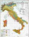
The gravimetric map of Italy at 1:1,000,000 scale was carried out by the Geological Survey of Italy and by AGIP using 234,100 AGIP ground stations provided by AGIP, by the Geological Survey of Italy, by various Universities and Institutions and private companies and 6,200 stations seabed provided by AGIP and OGS. The Geological Survey of Italy was responsible for the data collection and standardization. The map represents the Bouguer isoanomale calculated using a density of 2.67 g/cm3; the topographic correction was calculated by AGIP up to 20 km from the station point and by the Geological Survey of Italy from 20 Km to 166,736 km from the station point. The isoanomale, two-colors, are plotted with equidistance of 10 mGal on a topographic-geological base, with relative legenda, derived from "Mining Map of Italy" at 1:1,000,000 scale (Geological Survey of Italy, Rome, 1973).
View the Charter Gravimetric at 1:1,000,000 scale