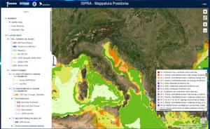
PNRR WED – Complete mapping of the italian coast and coastal habitats launch of the WebGis platform – Cloud
The PNRR MER project is an ambitious initiative that aims to map the entire Italian coast in detail, both the emerged and submerged parts. The project's coverage area extends up to 800 meters landward and up to 50 meters depth at sea, including the boundaries of marine protected areas and Natura 2000 sites.
A crucial element of the project is the development of a WebGIS – Cloud platform, currently in beta version, which allows access to the collected data and real-time monitoring of mapping activities.
The platform will allow you to track the location of planes and ships used for surveys on a daily basis, receive campaign reports, as well as verify and test the acquired data. Platform: Virgeo - ISPRA (ispra-virgeo.com)
The verification and control of the data are carried out in collaboration with numerous research bodies and institutions, including the Hydrographic Institute of the Navy (IIM), the Institute of Environmental Geology and Geoengineering (IGAG) of the CNR, La Sapienza University (DICEA), University of Padova (CIRGEO), Polytechnic of Milano (DICA), the National Institute of Geophysics and Volcanology (INGV), the University of Genova (DISTAV), and the University of Palermo (Department of Earth and Marine Sciences).
This project represents an important step forward in the monitoring and protection of Italian marine and coastal ecosystems, offering a powerful tool for the management and conservation of the country's natural heritage and coastal infrastructure.

