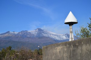
Geodetic monitoring of ISPRA in the area of December 26th Etna seismic event
Geodetic network of ISPRA, located in the south-est flanck of the Etna volcano (SiorNet network) is monitoring the surface deformations related to the earthquake sequence that hit this area from December 24th, with the main shock Ml4.8 occurred at 3:19 of 26th local time, likely related to the Fiandaca Fault.
The GNSS network, lately restored by the Geodetic Group of the Geological Survey of Italy-ISPRA, controls the movement of this sector since 10 years by 5 continuous GPS stations and 10 survey mode benchmarks along the acese area.
The preliminary analysis of the first data set of the ISPRA-SiorNet monitoring stations provided a first indication of the movement in the epicentral area.

