The national IdroGeo platform on hydrogeological instability: data and services for the PA and companies
ISPRA meets decision makers and stakeholders
The conference "The IdroGEO national platform on hydrogeological instability: data and services for the PA and companies - ISPRA meets decision makers and stakeholders", organized as part of the Open Gov Week, will be held on 30 May.
ISPRA will present the balance sheet on data and services provided by the national IdroGEO platform, four years after its launch in May 2020.
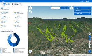
The IdroGEO Platform is an open data, open source and multilingual web application that allows you to view, query, download and share maps and data on hydrogeological instability in Italy.
It is a communication and information dissemination tool, to support decisions in the context of risk mitigation policies, territorial planning, preliminary planning of infrastructures, planning of structural soil defense interventions, management of hydrogeological emergencies and of environmental assessments.
As part of the event, the new functions for consulting and sharing hazard data and maps, hydrogeological risk indicators and the Inventory of Landslide Phenomena in Italy will be presented. The event will constitute a moment of meeting and discussion with decision makers, businesses, professions, universities and associations.
- https://development.isprambiente.gov.it/en/ispra-events/the-national-idrogeo-platform-on-hydrogeological-instability-data-and-services-for-the-pa-and-companies
- The national IdroGeo platform on hydrogeological instability: data and services for the PA and companies
- 2024-05-30T09:00:00+02:00
- 2024-05-30T13:30:00+02:00
- ISPRA meets decision makers and stakeholders The conference "The IdroGEO national platform on hydrogeological instability: data and services for the PA and companies - ISPRA meets decision makers and stakeholders", organized as part of the Open Gov Week, will be held on 30 May. ISPRA will present the balance sheet on data and services provided by the national IdroGEO platform, four years after its launch in May 2020. The IdroGEO Platform is an open data, open source and multilingual web application that allows you to view, query, download and share maps and data on hydrogeological instability in Italy. It is a communication and information dissemination tool, to support decisions in the context of risk mitigation policies, territorial planning, preliminary planning of infrastructures, planning of structural soil defense interventions, management of hydrogeological emergencies and of environmental assessments. As part of the event, the new functions for consulting and sharing hazard data and maps, hydrogeological risk indicators and the Inventory of Landslide Phenomena in Italy will be presented. The event will constitute a moment of meeting and discussion with decision makers, businesses, professions, universities and associations. Program
- When May 30, 2024 from 09:00 AM to 01:30 PM (Europe/Berlin / UTC200)
- Where Roma, Palazzetto Mattei in Villa Celimontana
-
Add event to calendar
iCal

