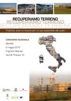
The first Italian map of land use online: regions, provinces and municipalities in open data
- https://development.isprambiente.gov.it/en/archive/ispra-events/year-2015/may/the-first-italian-map-of-land-use-online-regions-provinces-and-municipalities-in-open-data
- The first Italian map of land use online: regions, provinces and municipalities in open data
- 2015-05-06T09:00:00+00:00
- 2015-05-06T18:30:00+00:00
- When May 06, 2015 from 09:00 AM to 06:30 PM (GMT+0 / UTC0)
- Where Milano - Frigoriferi Milanesi, Via G.B. Piranesi, 10
-
Add event to calendar
iCal
Gain Ground. Policies, Actions and Measures for Sustainable Land Use
Ispra will present the first "Italian map" on national land use next 6 May. The Institute, thanks to the new high resolution mapping, has defined the perimeter the artificial covering of the whole peninsula in detail and providing, for the first time, all information relating to Regions, Provinces and Municipalities.
It will be also organized by ISPRA and the Forum Save the landscape, with the support of Slow Food Italy, the scientific conference "Let’s gain land".
The event, collateral to the Expo 2015, is part of the initiatives related to the International Year of soils and the Green Week 2015 of the European Commission
All the data will be available from the 6 May
Soil Consumption in Italy - main tables
Soil Consumption in Italy - tables of Municipalities, Province and Regions

