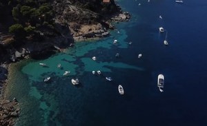
International Mediterranean Sea Day
The Mediterranean is a sea of wonders, history, culture and beauty to be protected and enhanced: a heritage that is celebrated on 8 July through an International Day. With the PNRR's MER (Marine Ecosystem Restoration) project, ISPRA is building a laboratory to map, restore and protect one of the richest - and most fragile - marine ecosystems on our planet with the aim of safeguarding its biodiversity and handing it over to future generations .
The mapping of coastal habitats is already being developed thanks to the LiDAR sensor, one of the pillars on which this program is based which intends to trace the seabed on 7,500 km of coast, surveying over 70 seamounts and investigating remote and unknown areas.
Another highlight: the new oceanographic vessel, the result of joint work carried out thanks to the precious collaboration with the Navy, which will be able to carry out monitoring activities in deep waters.
To support monitoring activities, ISPRA is building the Mobile Oceanographic Research Unit (UMRO), a sentinel van, to monitor the state of the sea, the field of surface currents and measurement of the depth of the coastal seabed.
The strengthening of sea level measuring stations in the lagoons of Venice and Marano Grado is also underway to predict extreme events and support coastal risk management.
All data collected will be accessible through an information platform, allowing mitigation measures to be planned to address the challenges posed by climate change in the Mediterranean Sea
- https://development.isprambiente.gov.it/en/news/international-mediterranean-sea-day
- International Mediterranean Sea Day
- 2024-07-08T00:00:00+02:00
- 2024-07-08T23:59:59+02:00
- The Mediterranean is a sea of wonders, history, culture and beauty to be protected and enhanced: a heritage that is celebrated on 8 July through an International Day. With the PNRR's MER (Marine Ecosystem Restoration) project, ISPRA is building a laboratory to map, restore and protect one of the richest - and most fragile - marine ecosystems on our planet with the aim of safeguarding its biodiversity and handing it over to future generations . The mapping of coastal habitats is already being developed thanks to the LiDAR sensor, one of the pillars on which this program is based which intends to trace the seabed on 7,500 km of coast, surveying over 70 seamounts and investigating remote and unknown areas. Another highlight: the new oceanographic vessel, the result of joint work carried out thanks to the precious collaboration with the Navy, which will be able to carry out monitoring activities in deep waters. To support monitoring activities, ISPRA is building the Mobile Oceanographic Research Unit (UMRO), a sentinel van, to monitor the state of the sea, the field of surface currents and measurement of the depth of the coastal seabed. The strengthening of sea level measuring stations in the lagoons of Venice and Marano Grado is also underway to predict extreme events and support coastal risk management. All data collected will be accessible through an information platform, allowing mitigation measures to be planned to address the challenges posed by climate change in the Mediterranean Sea
- When Jul 08, 2024 (Europe/Berlin / UTC200)
-
Add event to calendar
iCal

