PNRR MER - Integral mapping of the Italian coast and coastal habitats. Intervention A16-A18 and coastline
The PNRR MER project aims to fully map the Italian coast, both the emerged and submerged parts. The area covered includes the coast up to 800 meters towards land and up to 50 meters deep at sea, extending to the borders of marine protected areas and Natura 2000 sites.
The mapping of coastal habitats is carried out via aerial flights equipped with Topographic LiDAR sensors, which create a 3D "digital atlas" of the Italian coast. This survey, which covers 7,500 km of coastline, will provide useful data for the analysis and protection of species and habitats.
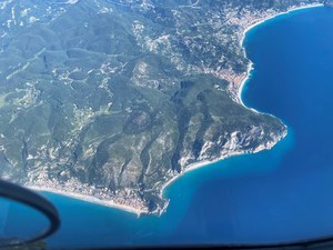
The detection takes place with a specific Topographic LiDAR sensor mounted on an aircraft, flying at an average altitude of 2,800 meters. The images collected will be used to model the coast and support habitat protection and coastal defense strategies. The campaign is already underway in several regions of Liguria, Toscana, Lazio and Campania and the data will be available starting from autumn 2024.
The project aims to strengthen the monitoring of Italian marine and coastal ecosystems, providing detailed information on the morphology of the coast and supporting decisions for the protection of coastal infrastructure.

