Istituto Superiore per la Protezione
e la Ricerca Ambientale

Cerca

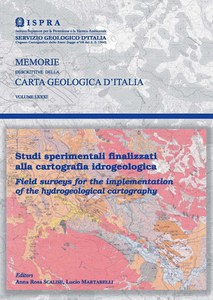
Field surveys for the implementation of the hydrogeological cartography

The hydrogeological mapping represents concisely and in global form the main hydrogeological information existing on a determined territory and is an indispensable work for those working in the field. The studies described in this publication have been obtained from hydrogeological information collected in sample areas of different situations of Italian territory and aimed at testing guidelines for a best cartographic representation.


Publication in Italian

Cost of the volume 25,00 € TAX included

Instructions for purchase


Technical Periodicals
Memorie Descrittive della Carta geologica d'Italia
Vol. 81/2008
978-88-240-2945-2
0536-0242
Summary

Index

Introduction

MARI G.M. - Guide to surveying and mapping of the Hydrogeological Map of Italy at 1:50.000 scale. Experimental applicability check. Aim and contents of the research project.Preliminary findings and evaluations

TACCHIA D. - Experimental cartography on hydrogeological numeric data

ROMA M. & VITALE V. - Information tools and methodologies applied to hydrogeology: from data supply to cartographic representation

CAPELLI G., MAZZA R., PAGANELLI D. & SCALISE A.R. - Experimental hydrogeological cartography in the south-eastern sector of the Monti Cimini (Latium)

BONI C.F., TARRAGONI C & MARTARELLI L. - Experimental hydrogeological cartography in the north-western sector of the Monti Sibillini (Marche)

CELICO P.B., CELICO F.  & CACCIUNI A. - Experimental hydrogeological cartography in the Monti del Matese and Monte Totila districts (Campania-Molise, Italy)

MARTARELLI L., PETITTA M., SCALISE A.R. & SILVI A. - Experimental hydrogeological cartography of the Rieti Plain (Latium)

MARTARELLI L., PARIS F., PETITTA M., RIVELLINO S. SCALISE A.R. & SILVI A. - Experimental hydrogeological cartography of the Canera Stream Basin (Rieti, Latium)

TABLES

Tab. I - Capelli G., Mazza R., Paganelli D., Scalise A.R. - Experimental hydrogeological cartography in the south-east of Monti Cimini

Tab. II - Boni C.F., Tarragoni C., Martarelli L. - Experimental hydrogeological cartography in the north-west of Monti Sibillini

Tab. III - Celico P.B., Celico F., Cacciuni A. - Experimental hydrogeological cartography of the Matese Mountains and Monte Totila  areas (Campania-Molise)

Tab. IV - Martarelli L., Petitta M., Scalise A.R., Silvi A. - Experimental hydrogeological cartography of the Piana Reatina (Latium)

Tab. V - Martarelli L., Paris F., Petitta M., Rivellino S., Scalise A.R., Silvi A. - Experimental hydrogeologal cartography of the Canera Creek (Rieti, Latium)


Download the volume (tables excluded) (30 Mb)