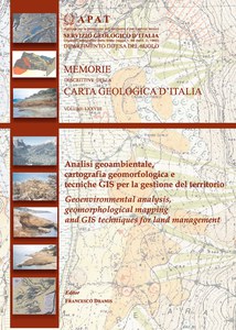
Geoenvironmental analysis, geomorphological mapping and GIS techniques for land management
In this volume are gathered the proceedings of the AIGEO (Geomorphology Italian Society) Meeting held in Rossano (Cosenza) from 19th to 21st May 2005, as a tribute to the intense, perculiar and influential work performed by Lamberto Pannuzi, geologist of the Italian Geological Survey, dead in 2004.
Click on "Summary" to view the files in .pdf format
Cost of the volume 20,00 € TAX included
- Summary
-
In memory of Lamberto Pannuzi (1928-2004)
Barbieri M., Coratza P. & Piacentini D. - GIS for the management and improvement of geological heritage: examples from the Upper Val Badia (Dolomites, Italy)
Beneduce P., Di Leo P., Filizzola C., Giano S.I. & Schiattarella M. - Assessment of hazard by asbestos release from natural materials: the case of Mt. Pollino (southern Italy)
Capolongo D., Marangi M., Albanese F., & Pennetta L. - Digital terrain models from satellite images: analysis and validation of ASTER DEMs for geomorphological applications
Chiarini E. & La Posta E. - Geological and geomorphological investigations in the Arsoli area (middle Aniene Valley, Rome)
Cipolloni C., Cecili A., Dramis F. & Graciotti R. - A conceptual model of data-bank for a computer-based geomorphological map: some case studies
De Amicis M. -Assessment of floods
Fubelli G., Vinci S., Abebe B. & Dramis F. - Large scale geomprphological mapping and GIS analysis of the slope processes in the Dessie (Wollo, Etiopia)
Ghinoi A. - A new methodology to evaluate land susceptibility to snow avalanches: how to improve the Location Map of Probable Snow Avalanches (L.M.P.S.A.) from the Snow Avalanches Inventory Data
Giardino M., Alberto W. & Perotti L. - Geomatics-Geomorphology integration for the analisys of morphostructures and deep-seated gravitational slope deformations. Application in the Susa Valley (Western Alps)
Graciotti R. & D'Orefice M. - Geomorphological and sedimentological features on the aeolian deposits in the western sector of the Mt. Calamita promontory (Elba Island - Italy)
Guerricchio A., Biamonte V., Mastromattei R. & Ponte M. - Gravitational slope deformations and liquefaction landslides triggered by the 1783 Calabria earthquake in the Polistena-Cinquefondi territory
Lo Curzio S. & Russo F. - Evidences of geoenvironmental changes in the Occhito Lake area (southern Italy) deduced from multi-temporal analisys of satellite images
Marini A., Melis M.T., Pitzalis A., Talbi N. & Gasmi N. - The geomorphic units map of the Medenine Region (southern Tunisia)
Melelli L., Taramelli A., & Nucci G. - Bivariate statistical analisys in GIS environment: a case of application to landslide susceptibility
Pellegrino A., La Pietra T. & Caracciolo T. - Data base processing from geomorphological survey and DIF-SAR interferometry: the case of Acri and S. Luca (Calabria)
Piacentini D. - ArcGIS 8.3 for the analisys of unstable rocky escarpments in the Dolomites (Bolzano, Italy)
Pignatelli C., De Leonardis M., Mastronuzzi G. & Sansò P. - Assessment of extreme waves impact along the Capo San Vito-Polignano coast (Puglia, Italy) by means of GIS technniques
Robustelli G., Muto F., Scarciglia F., Pulice I. & Aiello M. - The lower-middle Pleistocene marine terraces of the River Lao valley: stratigraphic considerations and morphoevolutive implications
Salvini R. - Morphometric analisys of the Crete Senesi by means of Remote Sensing and GIS
Scarciglia F., Vecchio G., De Rosa S., Robustelli G., Muto F., Le Pera E. & Critelli S. - The contribution of pedology to geomorphological analisys. The case of Sila (Calabria, Southern Italy)
Sterlacchini S., Salvi F., Sironi S. & Zanchi A. - 3D geological reconstructions: methologies and case studies
Taramelli A., Melelli L. Cattuto C. & Gregori L. - A case of geomorphic parametrization from SRTM data

