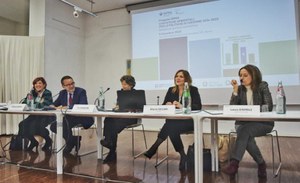
Environmental statistics for Cohesion policies 2014-2020
In the context of Cohesion policies, since May 2018 ISPRA has been the beneficiary of the "Environmental statistics for Cohesion policies 2014-2020" project aimed at expanding the set of territorial indicators on environmental matters, satisfying on the one hand the new international information requests and at the same time align the availability of data and indicators with the needs of implementer of national and local public policies.
- https://development.isprambiente.gov.it/en/ispra-events/environmental-statistics-for-cohesion-policies-2014-2020
- Environmental statistics for Cohesion policies 2014-2020
- 2023-12-06T09:30:00+01:00
- 2023-12-06T13:00:00+01:00
- In the context of Cohesion policies, since May 2018 ISPRA has been the beneficiary of the "Environmental statistics for Cohesion policies 2014-2020" project aimed at expanding the set of territorial indicators on environmental matters, satisfying on the one hand the new international information requests and at the same time align the availability of data and indicators with the needs of implementer of national and local public policies.
- When Dec 06, 2023 from 09:30 AM to 01:00 PM (Europe/Berlin / UTC100)
- Where Rome, Palazzo Madama
-
Add event to calendar
iCal
46 indicators have been published, 25 of which are also at municipal level and also several "new" indicators in line with the SDGs of Agenda 2030 and therefore with the methodological indications of the United Nations. The indicators are specific for various environmental issues such as: waste, air quality, water quality, atmospheric emissions, contaminated sites (within regional jurisdiction), hydrogeological hazards (landslides and floods), land consumption, territorial fragmentation and state of habitat conservation, coastal dynamics.
In addition to the indicators, the true core of the project, activities were also carried out, always preparatory and functional to populating the indicators, but also of their own relevance in terms of diffusion and wider use.
In particular:
- the open source and open data IdroGEO platform was created, not only for consulting and sharing data, maps, reports and documents on hydrogeological risk, but also to offer an interactive, participatory tool for the population
- the national database (MOSAICO) was developed for the sites subject to the remediation process
All project outputs (data, metadata and indicators) are published through ISPRA communication channels and in particular a specific section has been allocated for the Project.
An overview of the outputs summarized above will be presented in a specific technical-scientific report distributed on the occasion of the final event of the project which will take place on Wednesday 6 December 2023 at 9.30 am at Palazzo Merulana in Rome.
Presentations
Le statistiche ambientali per le politiche di Coesione 2014-2020: Risultati del progetto
Mariaconcetta Giunta, ISPRA
IdroGEO: la piattaforma per la gestione e comunicazione dei dati sul dissesto idrogeologico in Italia
Alessandro Trigila, ISPRA
MOSAICO: il database dei siti oggetto di procedimento di bonifica
Eugenia Bartolucci, ISPRA
Prototipo di geodatabase su Habitat d’interesse comunitario
Pierangela Angelini, ISPRA
Politiche di coesione e statistiche territoriali ambientali
Pia Marconi, Dipartimento per le Politiche di Coesione e per il Sud - Presidenza del Consiglio dei Ministri
L’uso di indicatori territoriali nell’ambito del PNRR
Aline Pennisi, Enrica Maria Martino, Unità di Missione NG-EU Ragioneria Generale dello Stato - MEF
Statistiche ambientali e attività del NRVVIP Calabria
M. Francesca Currà, Nucleo Regionale di Valutazione e Verifica degli Investimenti Pubblici (NRVVIP) - Regione Calabria

