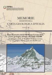
Explanatory Notes of the sheet 070 Monte Cervino of the geological Map of Italy at 1:50,000 scale
The Monte Cervino Sheet (No. 070) of the Geological Map of Italy at 1:50,000 scale covers a high mountain area of about 572 square kilometers, on the border between Italy and Switzerland. In particular, 423 square kilometers are located in the Valle d'Aosta Autonomous Region and the remaining 149 square kilometers in the Canton of Valais. The sheet is located, for the Italian stretch, on the left side of the middle Valle d'Aosta, north of the Chatillon Sheet (091), east of the Gran San Bernardo Sheet (069) and to the west of the Monte Rosa Sheet (071) and includes three large glacial valleys, the Valtournenche, the Valley of St Barthélemy and the Valpelline, while for the Valaisan area it is located at the head of the high glacial valleys between the Mattertal (Zermatt) and the Val de Bagnes. We are in the heart of the Pennine Alps, one of the most classic collecting areas of the western Alps, made famous by the De Saussure's journey (1779-96) and the Alpine "race" for the conquest of the Matterhorn, won by Whympler in 1865 along the Hörnli crest, followed three days later by Carrel along the most difficult Italian route of the Leone. It is a key sector to analyze the geological-structural order, the metamorphism and the geodynamic evolution of the northern covering flaps of the Austroalpinic System, their relations with the oceanic units of the Piedmontese area and the underlying continental units of the Middle-Pennidic system of the Big St. Bernardo. The natural split offered by the great walls of the Pennine Alps and the longitudinal corrugations, on a regional scale, of the stratum stack between the ossification-tectonic culmination of Ossola-Ticino and the sinformal depression Valle d'Aosta allow a three-dimensional view of the chain for a thickness of 25-30 km, while its hidden parts can be reconstructed interpreting the images produced by the great crust seismic experiments CROP-ECORS. In the area there are well preserved and sometimes spectacular forms of glacial modeling, as well as imposing gravitational deformations such as those of Torgnon and the White Peaks. Glacial and fluvioglacial deposits, distinguished in the Sheet in a succession of units, testify the phases of maximum expansion of the the last glaciation (LGM - Last Glacial Maximum) and the subsequent phases of retreat or cataglacial, still referable in part to the LGM and partly to the Tardoglacial, to which are followed, during the Holocene, the postglacial phases. The deposits of the glaciers of the Dora Baltea, welded in a succession of interconnected ice caps during the first part of the LGM, when the balteo glacier still reached the moraine amphitheater of Ivrea, over time differ in single branches, in relation to the progressive reduction in volume of ice, up to the headlands of the main valleys and tributaries. The best preserved glacial morphologies, such as the moraine system of the glacial system Grandes Murailles-Haut Glaicer de Tsa de Tsan, are those developed during the Little Ice Age (PEG), the last centuries-long period of glacial expansion that lasted from 1550 to 1860 A.D. During the PEG, also only 160 years ago, many glaciers now reduced to the lowest terms developed tongues of plurichilometric length. To PEG also refer most of the moraines on the Swiss side, to the Val de Bagnes, Val d'Hérens and Mattertal, more extensive than those in the Valle d'Aosta area due to the different weather conditions and the exposure of their basins.
Cost of the volume 26,00 € TAX included
Publication in Italian

