Geological reliefs
The current reorganization, combined with the systematic study by the Museum Activities Service of ISPRA, of the Palaeontological and Lithomineralogical Collections of the former Geological Survey of Italy, included the recognition and the analysis of geological models. Currently, the Collection consists of 17 geological reliefs of different sizes and metric scale, works made in various materials, from gypsum to wood to bronze.
These models were made following the instructions of specialists in the field, starting from the end of the nineteenth century, in conjunction with the start of the Geological Map of Italy.
Geologists and engineers were commissioned by the Royal Geological Survey to perform surveys on well-defined areas, and then publish technical reports on the institute Bulletins, the Regio Bollettino del Comitato Geologico d'Italia and Memorie per servire alla descrizione della Carta Geologica d'Italia (since 1886 only Memorie Descrittive), completing these studies, probably also for educational purposes, with the implementation of the related relief in painted gypsum or other material.
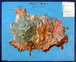
For some of these works we know the name of the geologist who has followed the work of relief plans, thanks to the handwritten signature, like the three-dimensional reliefs of the “Isola d'Elba” (1882) by Bernardino Lotti (1847-1933) and the “Isola d'Ischia” (1884-85) by Luigi Baldacci (1850-1927).
Around 1870 the Italian territories still lacking a modern cartographic documentation were quite extended. The Southern Italy, for example, did not have detailed topographic maps, which were carried out with considerable effort by the General Staff between 1862 and 1875, resulting in the expenditure of 2 million Liras, an enormous sum for the time. Consequently, the first field surveys of scholars of Royal Geological Survey, often resulted in the creation of a geological plan-relief, are extremely important, because they illustrate a first demographic and geomorphological structure of the country. This was shown also after major disasters, like the earthquake of Casamicciola (Ischia) in 1883, whose detailed study was commissioned the following year after the earthquake by Felice Giordano (1825-1892 ) to Baldacci.
At present, it seems that these three-dimensional geological reliefs have been carried out in the period going from the transfer of Geological Survey in Rome in 1875 to the First World War. The beginning of this activity coincides with the appointment, in 1876, of Felice Giordano at the direction of Royal Geological Survey, with the task of geological survey and systematic release of the Geological Map of Italy.
The direction of Giordano marks, despite financial constraints, the golden age of the great geological surveys on Italian soil, carried out with extreme accuracy and professionalism, as can be seen by the reliefs.
The reliefs of the former Geological Survey therefore belong to the historical memory of United Italy since 1870. Their scientific, economic and cultural value is then remarkable.
For these reasons, some of them – “Livorno con le isole Pianosa e Gorgona” (1914 ); “Isola d'Elba” (1882 ); “Isola d'Ischia” ( 1884-85 ); “Monte Soratte-Valle del Tevere” ( 1920 ca. ); “Sicilia” ( physical chart, ca. 1881); “Etna” (before 1870) - were chosen by the Central Museum of the Risorgimento (Monumental Complex of the Vittoriano, Piazza Venezia, Rome), to be exposed to the public, in 2006, on the occasion of the exhibition "Italy: Landscape and Territory". The exhibition was part of a broader government project, launched under the high patronage of the Presidency of the Republic and called "The Roots of the Nation. Italy Cultural Nation", which ended in 2011, coinciding with the celebrations of the 150th anniversary of the Unification of Italy, in which the whole of the Relief Collection was exhibited.
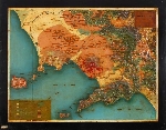
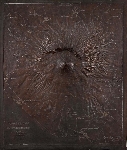
In the same 2006 year two more three-dimensional reliefs, the “Provincia di Napoli” (plaster, late nineteenth century) and “Monte Vesuvio” (bronze, 1870) represented the ISPRA (still called APAT at the times) at the exhibition "Naples and its volcano. Memories and documents", at Palazzo Roccella in Naples.
In 2012 ISPRA published the monograph “I Plastici Geologici del Servizio Geologico d’Italia” (The Geological reliefs of the Geological Survey of Italy, FULLONI, 2012, ISPRA-Collezioni Museali), which deals with the historical context of the works, analyzes the maps of which they are three-dimensional transpositions, and reports their filing according to the regulation of the Institute for Cataloguing and Documentation (ICCD), of the Ministry of cultural heritage and tourism (MiBACT).
The Collection of reliefs has been arranged in geographical order going from North to South Italy.
Type of Collection: historical, educational, ostensive.
 |
Gruppo del Monte Bianco Geological relief of the Mont Blanc Group - Scale 1 : 50,000 Inv.: R. Ufficio Geologico 148-I; Servizio Geologico 550 cat. I. Attributed to A. Aureli, 1900-1915 Painted gypsum with wooden frame Dimensions including the frame : 112 x 64 cm (x max 15 cm ) |
 |
Comune di Livorno e Isole Pianosa e Gorgona |
 |
Montecatini - Val di Cecina e dintorni Geological relief of Montecatini-Val di Cecina and its surroundings, 1883-85, by B. Lotti (Volterra 112) Scale: 1 : 25,000 Inv.: R. Ufficio Geologico 146; Servizio geologico 559, cat. I; D.S.T.N. 5843 cat. I. Attrib. Amedeo Aureli , 1883-1906 Painted gypsum with wooden frame Dimensions including the frame: 95 x 87 cm (x max 16 cm) |
 |
Dintorni di Massa Marittima Geological relief of the surroundings of Massa Marittima, 1893, by B. Lotti Scale: 1 : 25,000 Inv.: R. Ufficio Geologico 147; Ufficio Geologico d’Italia 215; Servizio Geologico 1080-I; D.S.T.N. 6004 cat. I. Attrib. Amedeo Aureli,1893 Painted gypsum with wooden frame Dimensions including the frame : 117 x 114 cm (x max 11 cm) |
 |
Isola d'Elba Geological relief of the Elba Island, 1882, by B. Lotti Scale: 1 : 25,000 Inv.: R. Ufficio Geologico 141-I; Ufficio Geologico d’Italia 209-I; Servizio Geologico 1079 cat. I; D.S.T.N. 6003 – cat. I Attributed to A. Aureli, post 1882 Painted gypsum with wooden frame Dimensions including the frame: 148 x 114 cm (x max 12 cm) |
 |
Monte Argentario Geological relief of the Monte Argentario Scale: 1 : 25,000 Inv.: D.S.T.N. 5842 cat. I 1919, Author A. Aureli Painted wood with wooden frame Dimensions including the frame: 98,5 x 84 cm (x max 12 cm) |
 |
Monte Soratte (Valle del Tevere) Geological relief of the Monte Soratte (Tiber Valley) Inv .: R. Ufficio Geologico 280 – I; R. Ufficio Geologico 143 –I; Servizio Geologico d’Italia 558 cat. I ; Servizio Geologico 982 cat. I. circa 1920, Unknown Author Scale: 1 : 25,000 Painted gypsum with wooden frame Dimensions including the frame: 44 x 40 cm (x max 6 cm) |
 |
Vulcano Laziale Geological relief of Latium Volcano Scale: 1 : 25,000 Inv : R. Ufficio Geologico 159; Servizio Geologico 561 cat. I; D.S.T.N. 5845 cat. I. Attributed to A. Aureli, late nineteenth century Painted gypsum with wooden frame Dimensions including the frame : 106 x 96 cm (x max 9 cm) |
 |
Dintorni di Roma Geological relief of the Surroundings of Rome, modeled and built by Domenico Locchi, late nineteenth century Scale: 1: 100,000 for heights as for the distances Inv : R. Ufficio Geologico 157; Servizio Geologico 561 cat. I; D.S.T.N. 5848 cat. I. D.S.T.N. 5848 cat. I Painted gypsum and paper with wooden frame Dimensions including the frame : 93 x 72 cm (x max 5 cm) |
 |
Campi Flegrei
|
 |
Provincia di Napoli e sue adiacenze Geological relief of the Province of Naples and its surroundings, Scale: 1: 100,000 for the height as for the distance Inv .: R. Ufficio Geologico 158; Servizio Geologico 556; D.S.T.N. 5840 cat. I Author: D. Locchi, late nineteenth century Painted gypsum and paper with wooden frame Dimensions including the frame : 100 x 78 cm (x max 10 cm) |
 |
Monte Vesuvio Topographical relief of Mount Vesuvio Scale: 1 : 25,000 for the horizontal, 1 : 20,000 for the vertical Inv.: R. Ufficio Geologico 156 –I; R. Ufficio Geologico 294 – I; Servizio Geologico 685 cat. I; D.S.T.N. 5901 cat. I. Major F. Pistoia, Florence, 1870 Zinc with galvanic copper plating Dimensions including the frame: 64.5 x 54,2 cm (x max 9 cm) |
 |
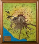
Monte Vesuvio 1906 Geological relief of the Mount Vesuvio after the eruption of 1906 Scale: 1 : 25,000 for the horizontal, 1 : 20,000 for the vertical Inv .: R. Ufficio Geologico 145 – I; Servizio Geologico 685 cat. I; D.S.T.N. 5835 cat. I. Author: A. Aureli Painted gypsum and paper with wooden frame Dimensions including the frame: 70 x 62 cm (x max 10 cm) |
 |
Isola d'Ischia Geological relief of the Island of Ischia , 1884-85, by L. Baldacci Scale 1 : 10,000 Inv.:.: R. Ufficio Geologico158; Servizio Geologico 684 cat. I; Geological Survey 684 cat. I; D.S.T.N. 7233 cat. I. Attributed to A. Aureli , 1884 Painted gypsum and paper with wooden frame Dimensions including the frame : 12 4 x100 cm (x max 18 cm) |
 |
Carta fisica della Sicilia Physical map of Sicily Scale: 1 : 640,000 for the horizontal ; 1 : 160,000 for the vertical Inv.: R. Ufficio Geologico 764 –I; Ufficio Geologico d’Italia521 – I; Servizio Geologico 646 cat. I; D.S.T.N. 465 cat. I. Author: Claudio Cherubini Late Nineteenth century Painted gypsum and paper with wooden frame Dimensions including the frame : 64 x 50 cm (x max x 5 cm ) |
 |
Rilievo Geologico della Sicilia Geological relief of Sicily Scale: 1 : 640,000 for the horizontal ; 1 : 160,000 for the vertical Inv .: R. Ufficio Geologico 154 –I; Servizio Geologico 555 cat. I; D.S.T.N. 5839 cat. I. Attributed to Claudio Cherubini, 1881 Painted gypsum and paper with wooden frame Dimensions including the frame : 71 x 55 cm (x max x 6.5 cm ) |
 |
Monte Etna Geological relief of Mount Etna Scale: 1 : 25,000 vertical, 1 : 50,000 horizontal N. Inv.: R. Ufficio Geologico 142 –I; Servizio Geologico 553 cat. I; D.S.T.N. 5837 cat. I. Capt. F. Pistoja (Istituto Topografico Militare); G. Manara (Regio Ufficio Geologico); 1877 Painted cast metal Dimensions including the frame : 133 x 105 cm (x max 20 cm) |
